
Pike and San Isabel National Forests & Cimarron and Comanche National Grasslands, Colorado
Do you manage this campground? Claim this page
At a glance: Confirmed: electric hookups and drinking water. No flush toilets. Listed for rigs up to 45 ft. Not listed: showers.
Get updates when fees or status change
Amenities
“Not listed” means the official sources don’t say - it does not mean “no”.
- Electric hookups Yes
- Drinking water Yes
- Flush toilets No
- Showers Not listed
- Dump station Not listed
- Water hookups at sites No
- Sewer hookups No
- Tent sites Yes
- RV / trailer sites Yes
- Reservable online Yes
Sites, fees and season
- Campsites
- 31
- Longest RV / trailer listed
- Up to 45 ft at selected sites (not every site; check access and your site)
- Elevation
- 8,591 ft
- Phone
- (719) 269-8500 (campground or managing office)
Fees are not listed in the official data. Check the official site before you go.
The listed length is the longest site; not every site fits that size. Confirm your site on the official reservation page.
From the official listing
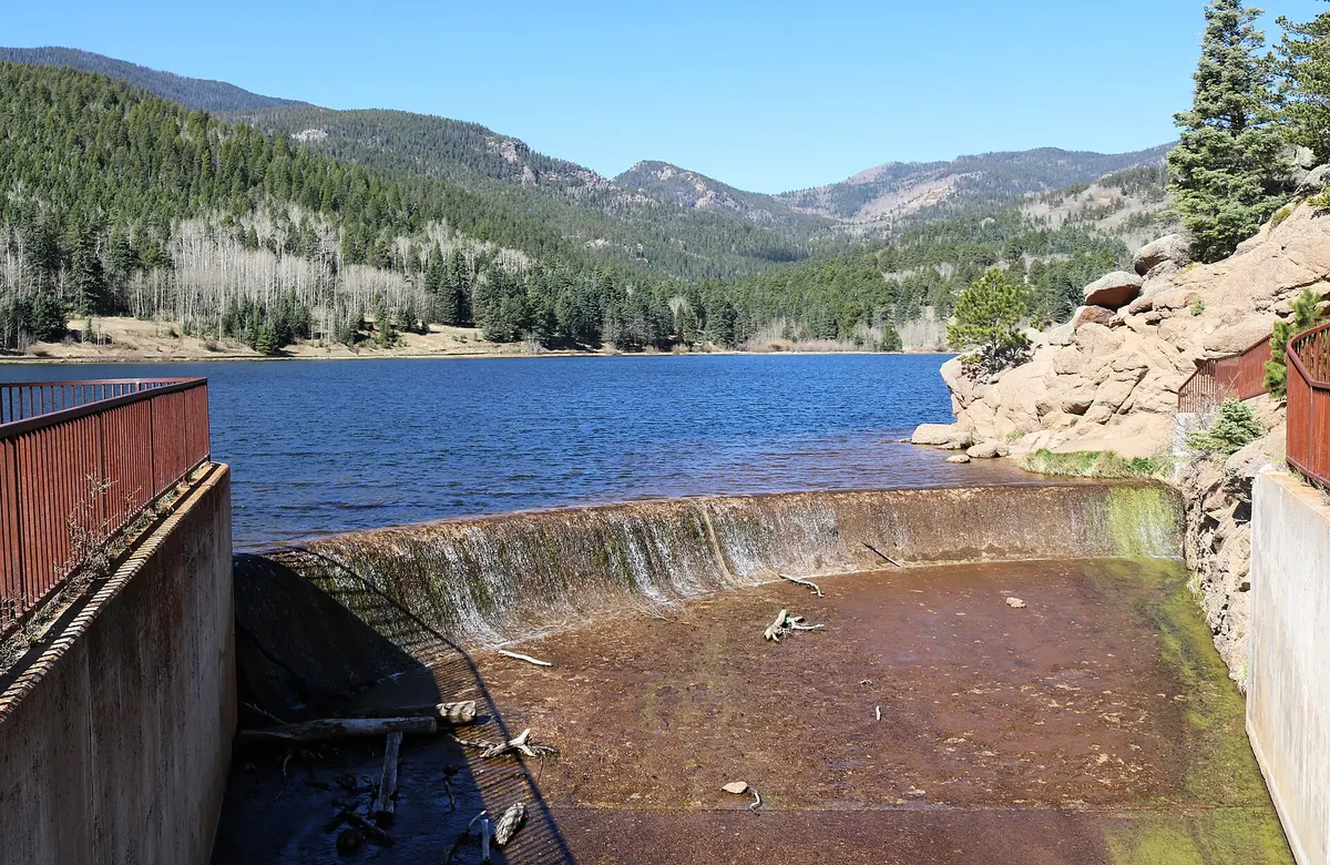
La Vista Campground is situated in a meadow overlooking the west side of the 40-acre Lake Isabel. It is set along the Frontier Pathways and Historic Byway in the Wet Mountains along one of the Colorado Birding Trails.
Lake Isabel is one of the few lakes in Colorado developed purely for recreation purposes. Built by the Civilian Conservation Corps, the lake attracts many campers who come to hike, canoe, fish and spend time bird watching. St. Charles Creek flows near the campground and offers additional fishing opportunities.
Recreation
Lake Isabel welcomes non-motorized boating and fishing. Brown and brook trout are stocked in the lake and the St. Charles headwaters reap brook trout.
Visitors can enjoy hiking, bicycling or motorcycling on either the Snow Slide Trail and Cisneros Trail. The 15-mile Cisneros Trail, also open to ATV riders, leads to the heart of the Wet Mountains, through forests and open, wildflower speckled valleys. Along the way, the trail connects to St. Charles Trail, which heads to St. Charles Peak.
Facilities
Walk-in tent sites are 15 to 50 yards from the parking spurs. RV sites come with electric hookups and all sites include a picnic table, campfire ring and access to vault toilets and drinking water.
Natural Features
Shady pine and aspen trees are scattered throughout the campground. At 8,600 feet, the area enjoys cool summer days, a welcome relief from the heat in the plains far below.
Climate by month
Average daily high and low and monthly precipitation, 1991-2020 normals from the NOAA station Sheep Mtn - 20.9 mi away, station at 7,744 ft - 847 ft lower than the campground (8,591 ft). Long-term averages, not a forecast; the open season is listed separately above.
| Month | High °F | Low °F | Precip. in |
|---|---|---|---|
| Jan | 41 | 17 | 0.50 |
| Feb | 42 | 18 | 0.72 |
| Mar | 50 | 23 | 0.82 |
| Apr | 57 | 28 | 1.39 |
| May | 66 | 36 | 1.32 |
| Jun | 77 | 45 | 0.80 |
| Jul | 82 | 51 | 2.29 |
| Aug | 79 | 50 | 2.34 |
| Sep | 73 | 43 | 1.00 |
| Oct | 62 | 33 | 1.00 |
| Nov | 49 | 24 | 0.86 |
| Dec | 40 | 17 | 0.60 |
Highlight months with an average high between and °F:
Location and nearby campgrounds
Location on the map · Driving directions · 37.98444, -105.05944 (the official listing point; check the access road for large rigs)
- Alvarado Campground 28.2 mi straight-line
- Pinon Flats Campground 29.5 mi straight-line
- Sand Gulch Campground 44.7 mi straight-line
- The Bank Campground 45.4 mi straight-line
- Bear Lake Campground (CO) 45.7 mi straight-line
Photos from visitors
No visitor photos yet. Photos of the sites, restrooms and the road in help the next camper decide.
Visitor reviews
No reviews yet. Have you stayed here? Your experience helps the next camper.
Log in to write a reviewCreate a free account
Reviews are the personal experience of registered visitors. They do not change the official facts above; a reported problem (for example "the water was off") is checked against the official sources.
Estimate your trip cost
Sources
| Fact | Source | Fetched from the source |
|---|---|---|
| Campsites | Recreation.gov (RIDB) | Oct 24, 2026 source updated Feb 25, 2026 |
| Reservable online | Recreation.gov (RIDB) | Oct 24, 2026 source updated Feb 25, 2026 |
| Tent sites | Recreation.gov (RIDB) | Oct 24, 2026 source updated Feb 25, 2026 |
| RV / trailer sites | Recreation.gov (RIDB) | Oct 24, 2026 source updated Feb 25, 2026 |
| Electric hookups | Recreation.gov (RIDB) | Oct 24, 2026 source updated Feb 25, 2026 |
| Water hookups at sites | Recreation.gov (RIDB) | Oct 24, 2026 source updated Feb 25, 2026 |
| Sewer hookups | Recreation.gov (RIDB) | Oct 24, 2026 source updated Feb 25, 2026 |
| Drinking water | Recreation.gov (RIDB) | Oct 25, 2026 source updated Feb 25, 2026 |
| Flush toilets | Recreation.gov (RIDB) | Oct 25, 2026 source updated Feb 25, 2026 |
| Longest RV / trailer listed | Recreation.gov (RIDB) | Oct 24, 2026 source updated Feb 25, 2026 |
| Elevation | USGS elevation (EPQS) | Oct 24, 2026 |
| Official page | Recreation.gov (RIDB) | Oct 24, 2026 source updated Feb 25, 2026 |
| Official reservations | Recreation.gov (RIDB) | Oct 24, 2026 source updated Feb 25, 2026 |
| Phone | Recreation.gov (RIDB) | Oct 25, 2026 source updated Feb 25, 2026 |
Last successful data update for this page: Oct 25, 2026. That is when we last read the official sources - not a personal visit, and not the date the source itself changed (shown per fact above). Found something wrong? Report an error.