
Tonto National Forest, Arizona
Do you manage this campground? Claim this page
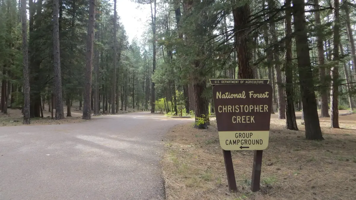
At a glance: Confirmed: electric hookups. Listed for rigs up to 22 ft. Not listed: drinking water, flush toilets and showers.
Get updates when fees or status change
Amenities
“Not listed” means the official sources don’t say - it does not mean “no”.
- Electric hookups Yes
- Drinking water Not listed
- Flush toilets Not listed
- Showers Not listed
- Dump station Not listed
- Water hookups at sites No
- Sewer hookups No
- Tent sites Yes
- RV / trailer sites Yes
- Reservable online Yes
Sites, fees and season
- Campsites
- 44
- Longest RV / trailer listed
- Up to 22 ft at selected sites (not every site; check access and your site)
- Elevation
- 5,704 ft
Fees are not listed in the official data. Check the official site before you go.
The listed length is the longest site; not every site fits that size. Confirm your site on the official reservation page.
From the official listing
With an elevation of 5640 ft, Christopher Creek Campground's crisp, fresh air and vibrant views are a joy to behold. The campground is tucked along the banks of the spring-fed Christopher Creek, which passes just below the Mogollon Rim. This campground is typically open April-November. The Mogollon Rim, pronounced by locals as "muggy-own," is a 200-mile long cliff in northern Arizona that ranges between 5,000 and 7,000 ft in elevation. The unique landscape was created by extreme erosion and faulting that has sculpted spectacular canyons and buttes. The rim serves as the geographical dividing line between the cool high country above and the hot, dry desert below. Christopher Creek is located in the desert portion, but is balanced by the cool waters of the creek and forested surroundings.
Recreation
After a day of exploring the natural beauty of Rim Country, sit back and relax in the shaded Ponderosa Pine Forest. Each spring, the creek is stocked with rainbow trout, allowing anglers the opportunity to cast their hearts out for rainbows as well as brook and brown trout.
Access the National Recreation Highline trail close by.
Natural Features
Christopher Creek provides creek side dwelling in Tonto National Forest, at the base of the Mogollon Rim. Sites are surrounded by ponderosa pines, junipers, oaks and manzanita evergreen shrubs.
Climate by month
Average daily high and low and monthly precipitation, 1991-2020 normals from the NOAA station Pleasant Valley - 14.9 mi away, station at 5,183 ft - 521 ft lower than the campground (5,704 ft). Long-term averages, not a forecast; the open season is listed separately above.
| Month | High °F | Low °F | Precip. in |
|---|---|---|---|
| Jan | 53 | 25 | 2.25 |
| Feb | 56 | 27 | 2.24 |
| Mar | 61 | 31 | 1.85 |
| Apr | 68 | 36 | 0.69 |
| May | 76 | 42 | 0.58 |
| Jun | 86 | 49 | 0.24 |
| Jul | 88 | 59 | 3.44 |
| Aug | 86 | 59 | 3.02 |
| Sep | 82 | 52 | 1.70 |
| Oct | 72 | 40 | 1.13 |
| Nov | 62 | 30 | 1.44 |
| Dec | 52 | 25 | 1.85 |
Highlight months with an average high between and °F:
Location and nearby campgrounds
Location on the map · Driving directions · 34.30806, -111.03472 (the official listing point; check the access road for large rigs)
- Mogollon Campground 4.5 mi straight-line
- Aspen (Az) 5.2 mi straight-line
- Crook Campground 5.3 mi straight-line
- Spillway (Az) 5.8 mi straight-line
- Rim Campground 7.2 mi straight-line
Photos from visitors
No visitor photos yet. Photos of the sites, restrooms and the road in help the next camper decide.
Visitor reviews
No reviews yet. Have you stayed here? Your experience helps the next camper.
Log in to write a reviewCreate a free account
Reviews are the personal experience of registered visitors. They do not change the official facts above; a reported problem (for example "the water was off") is checked against the official sources.
Estimate your trip cost
Sources
| Fact | Source | Fetched from the source |
|---|---|---|
| Campsites | Recreation.gov (RIDB) | Oct 25, 2026 source updated May 22, 2026 |
| Reservable online | Recreation.gov (RIDB) | Oct 25, 2026 source updated May 22, 2026 |
| Tent sites | Recreation.gov (RIDB) | Oct 25, 2026 source updated May 22, 2026 |
| RV / trailer sites | Recreation.gov (RIDB) | Oct 25, 2026 source updated May 22, 2026 |
| Electric hookups | Recreation.gov (RIDB) | Oct 25, 2026 source updated May 22, 2026 |
| Water hookups at sites | Recreation.gov (RIDB) | Oct 25, 2026 source updated May 22, 2026 |
| Sewer hookups | Recreation.gov (RIDB) | Oct 25, 2026 source updated May 22, 2026 |
| Longest RV / trailer listed | Recreation.gov (RIDB) | Oct 25, 2026 source updated May 22, 2026 |
| Elevation | USGS elevation (EPQS) | Oct 25, 2026 |
| Official page | Recreation.gov (RIDB) | Oct 25, 2026 source updated May 22, 2026 |
| Official reservations | Recreation.gov (RIDB) | Oct 25, 2026 source updated May 22, 2026 |
Last successful data update for this page: Oct 25, 2026. That is when we last read the official sources - not a personal visit, and not the date the source itself changed (shown per fact above). Found something wrong? Report an error.